
 Rheon
Rheon (ῥέον): «that which flows».
Drainage networks, rivers and culverts in one model
Design and hydraulic analysis of storm and combined sewers, rivers and open channels, culverts, pumps and regulators, with the rainfall-runoff that feeds them — from the survey to the drawings and the bill of quantities, on EPA SWMM.
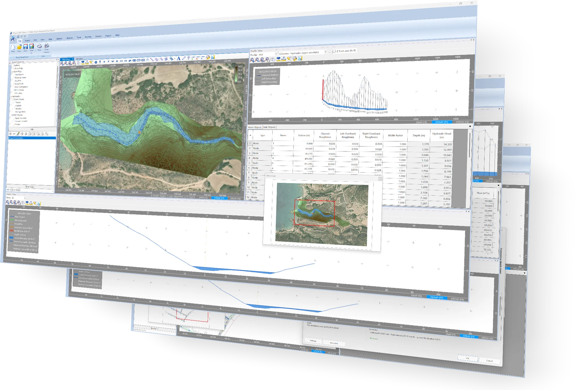
Rheon is a Windows program for the design and the hydraulic analysis of drainage networks: storm and combined sewers, rivers and open channels, culverts, storage units, pumps and regulators, with the rainfall-runoff that feeds them. Sewers, rivers and culverts, which engineering practice has long treated with separate tools, are here objects of one model, with their data, their methods and their drawings in one place.
The hydraulics are solved by EPA SWMM, the Storm Water Management Model of the US Environmental Protection Agency — the reference model for urban drainage in most of the world — by the dynamic wave: backwater, surcharge, pressurised flow, reversal, storage and the interaction of pipes with channels are all represented.
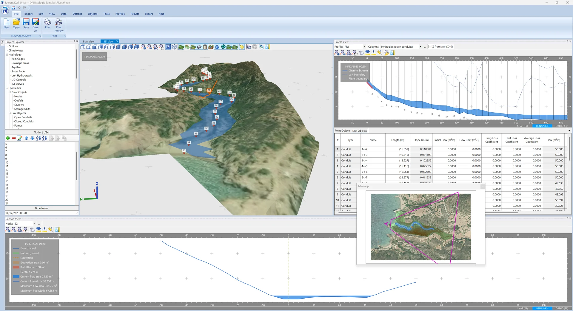
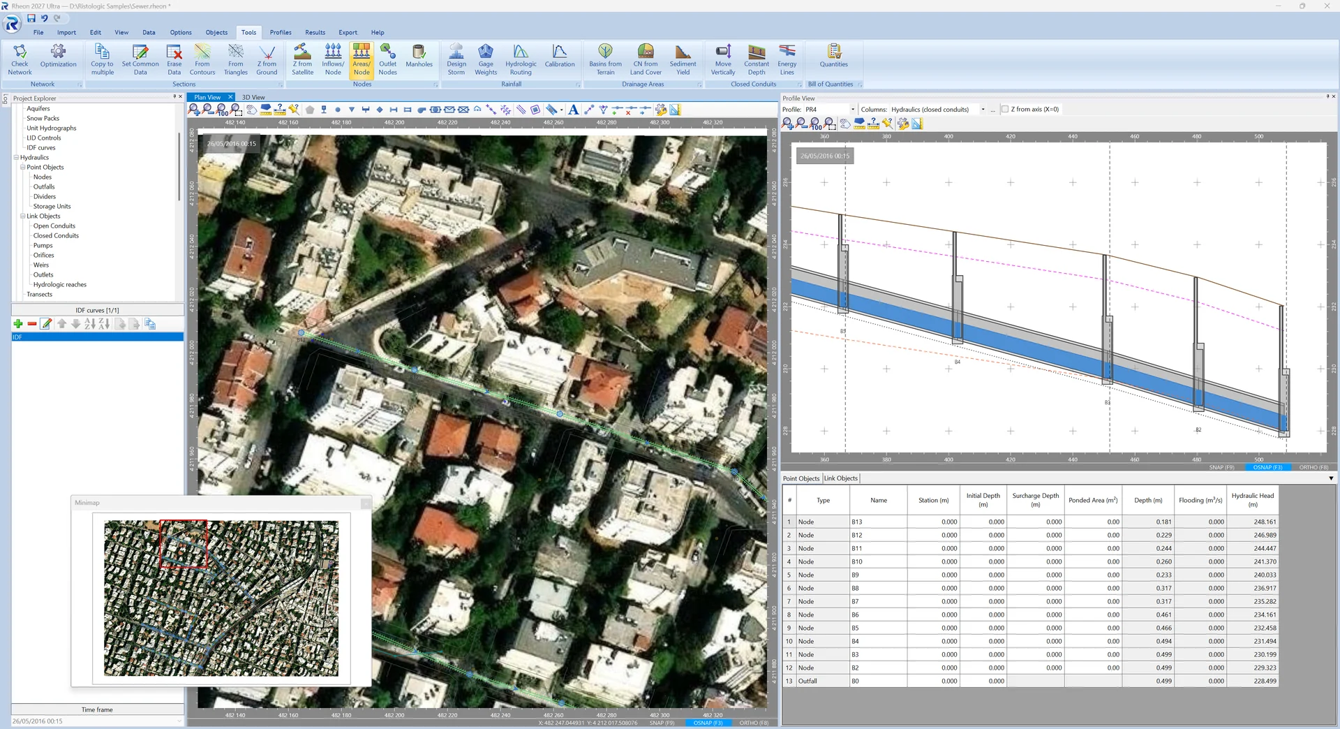
On top of the engine Rheon adds what an engineering office needs to go from a survey to a drawing and a bill of quantities: design flows, automatic inverts along the profiles, manholes and trenches, cross-sections from the terrain, culverts with their road, drainage areas from the terrain, gutters and inlets, drawings, reports and the exchange of data with the programs you already use.
What Rheon does
Sewers
Design flows from population, per-area consumers and the rational method; automatic inverts along the profiles with four alignment rules; manholes assigned by rule; pipe, manhole and trench libraries; checks of velocity and filling; conversion of nodes and links from one kind to another.
Rivers and channels
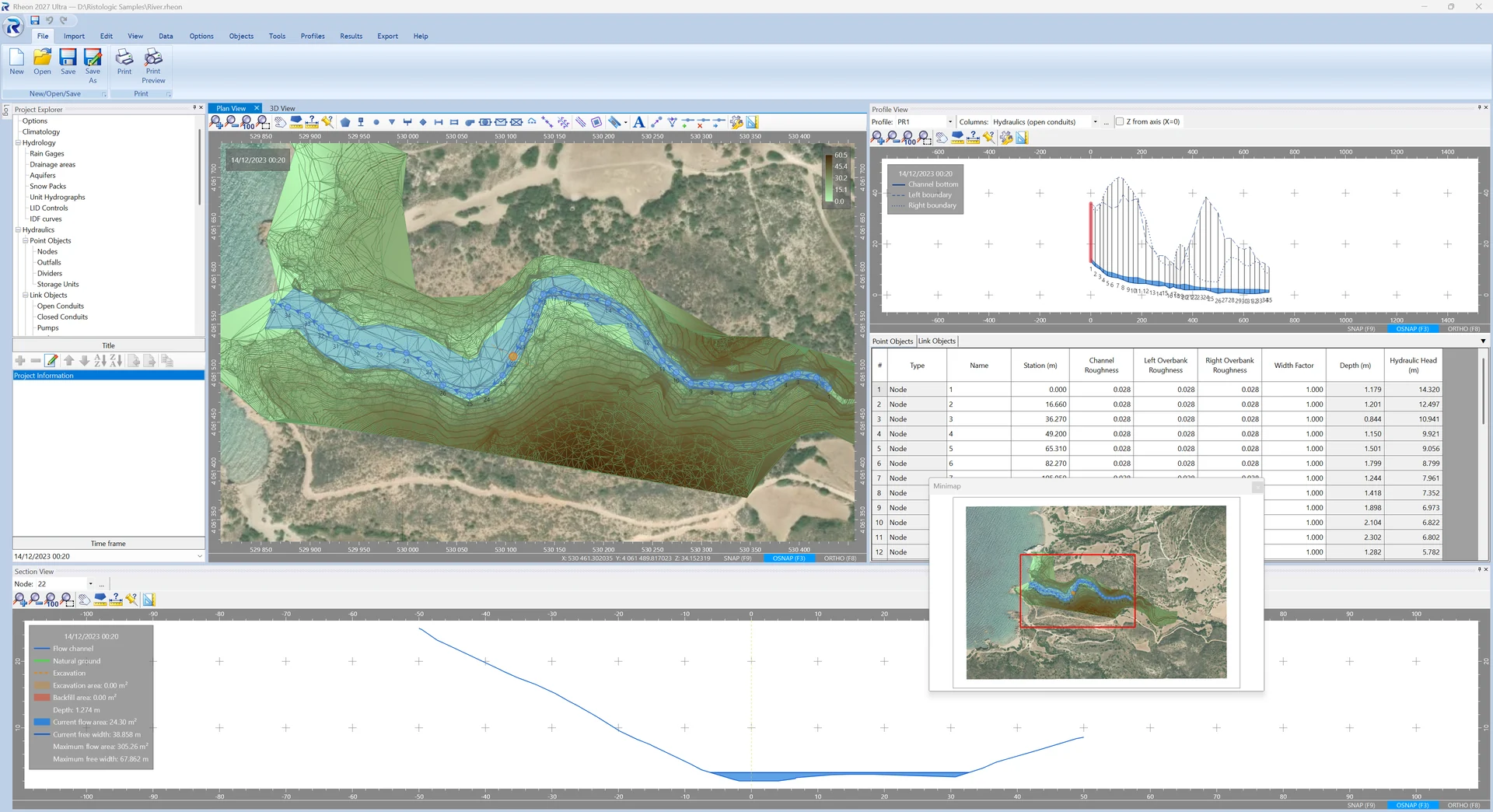
Surveyed cross-sections on the nodes, taken from contours, a surface or by hand; flood lines and edge lines from the results; flooding checks against the bank crests; natural ground, excavation ditch and flow channel as three independent lines.
Culverts
A culvert with its FHWA inlet geometry and a roadway weir between the same nodes, drawn in the profile with its road; the headwater, the split between barrel and road, inlet or outlet control.
Hydrology
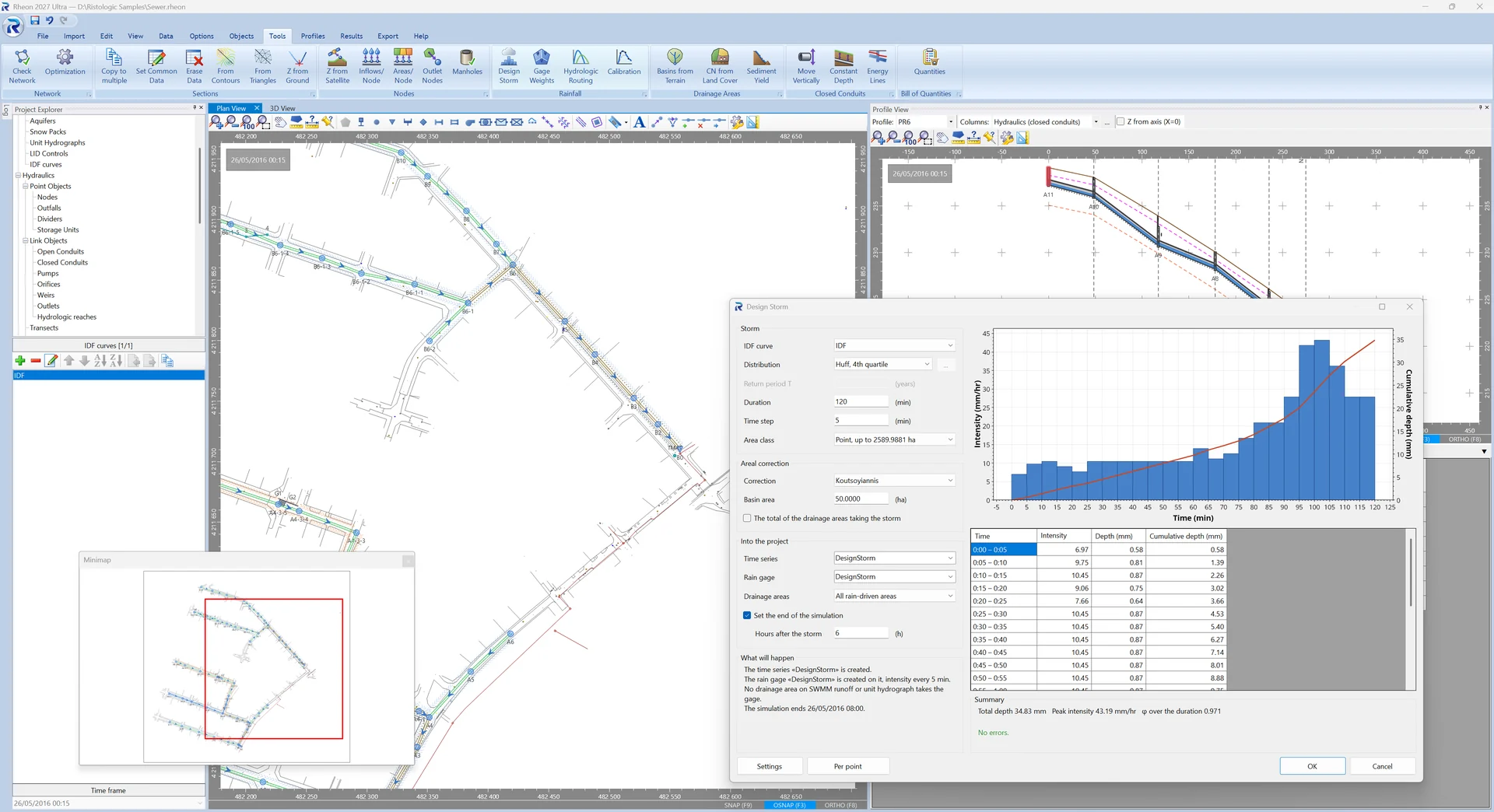
Drainage areas with runoff coefficients or SWMM's full subcatchment, IDF curves and design storms, rain gages and time series, unit hydrographs, snow packs, aquifers and LID controls; hydrologic routing and calibration to a measured flood.
Basins from the terrain Pro
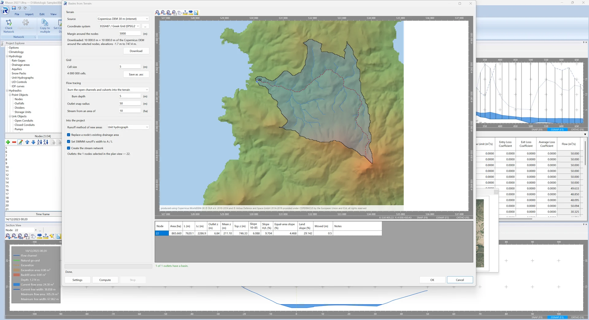
The basins, longest flow paths and slopes of the nodes you choose, traced on a TIN, contours, a GeoTIFF or the free Copernicus DEM, and created as drainage areas with their data; curve numbers from land-cover and soil maps.
Gutters and inlets Pro
Gutter spread and inlet interception to HEC-22 (2024), ΟΜΟΕ 12 or CD 526 with CG 501: grates, curb openings, combinations and slotted drains, on grade and in sags; inlets proposed where the spread asks for them and written into the SWMM model.
Drawings and 3D
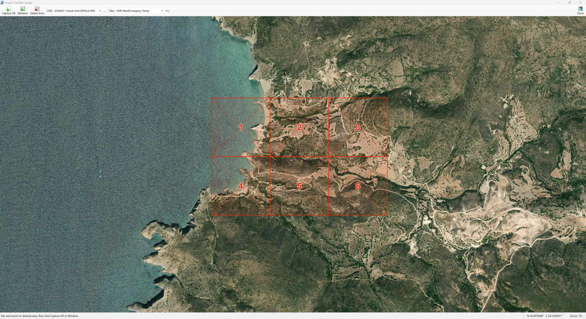
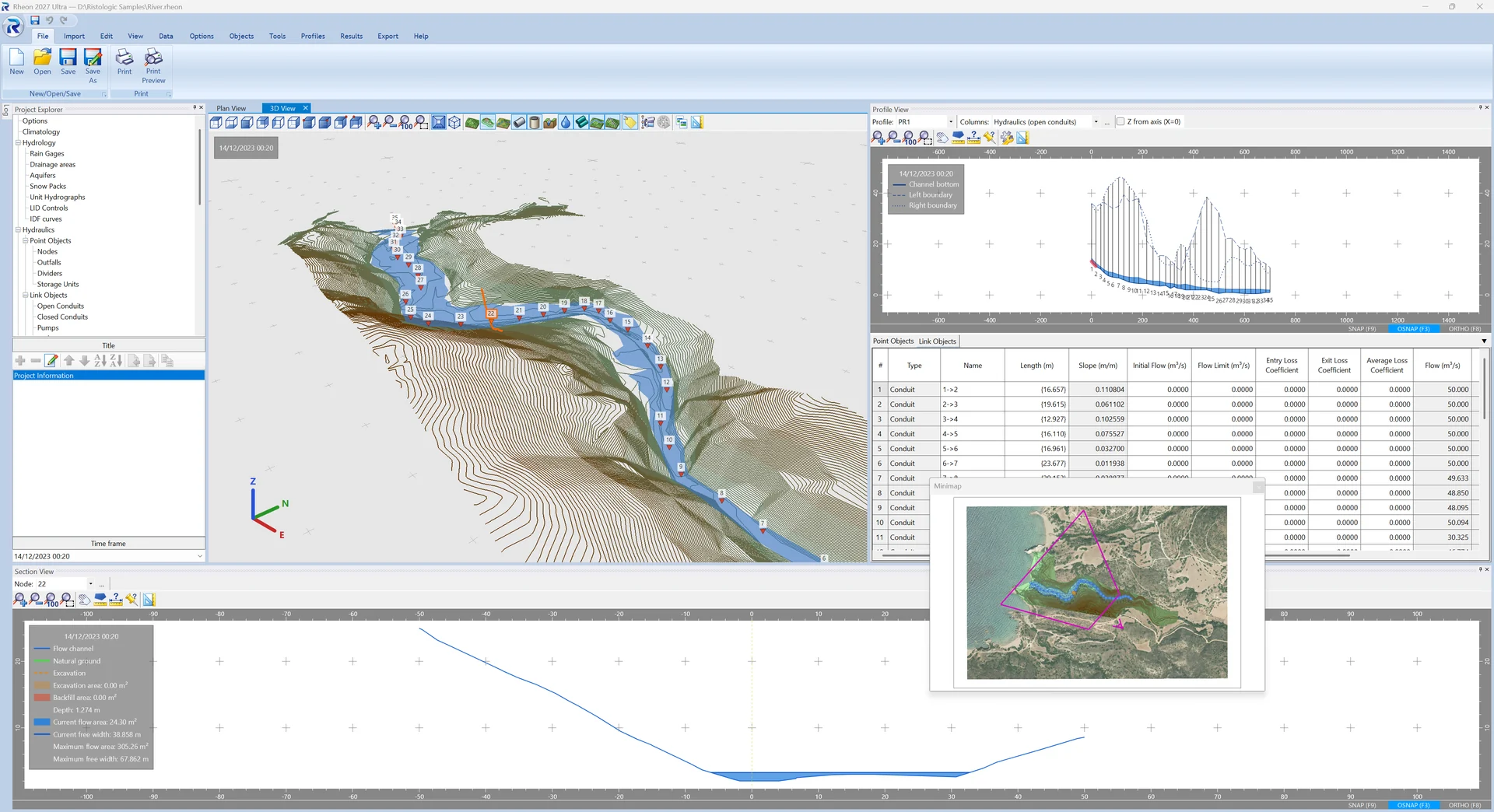
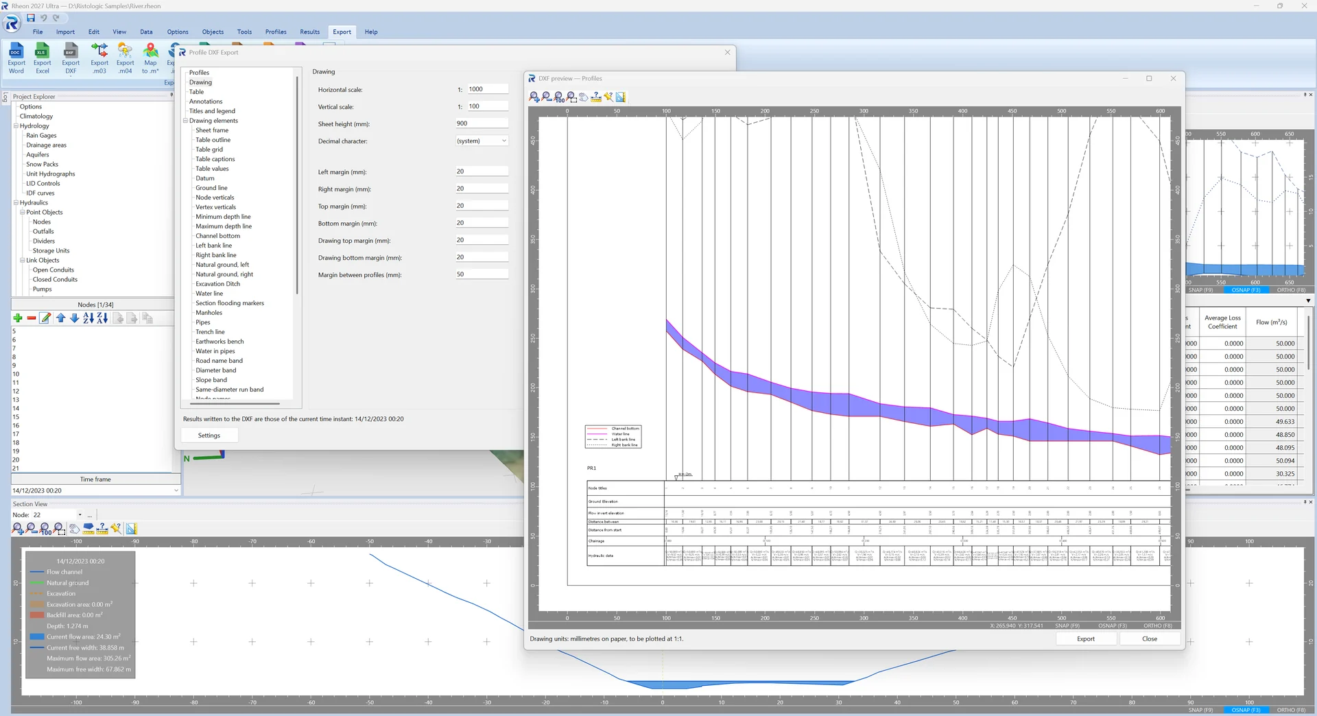
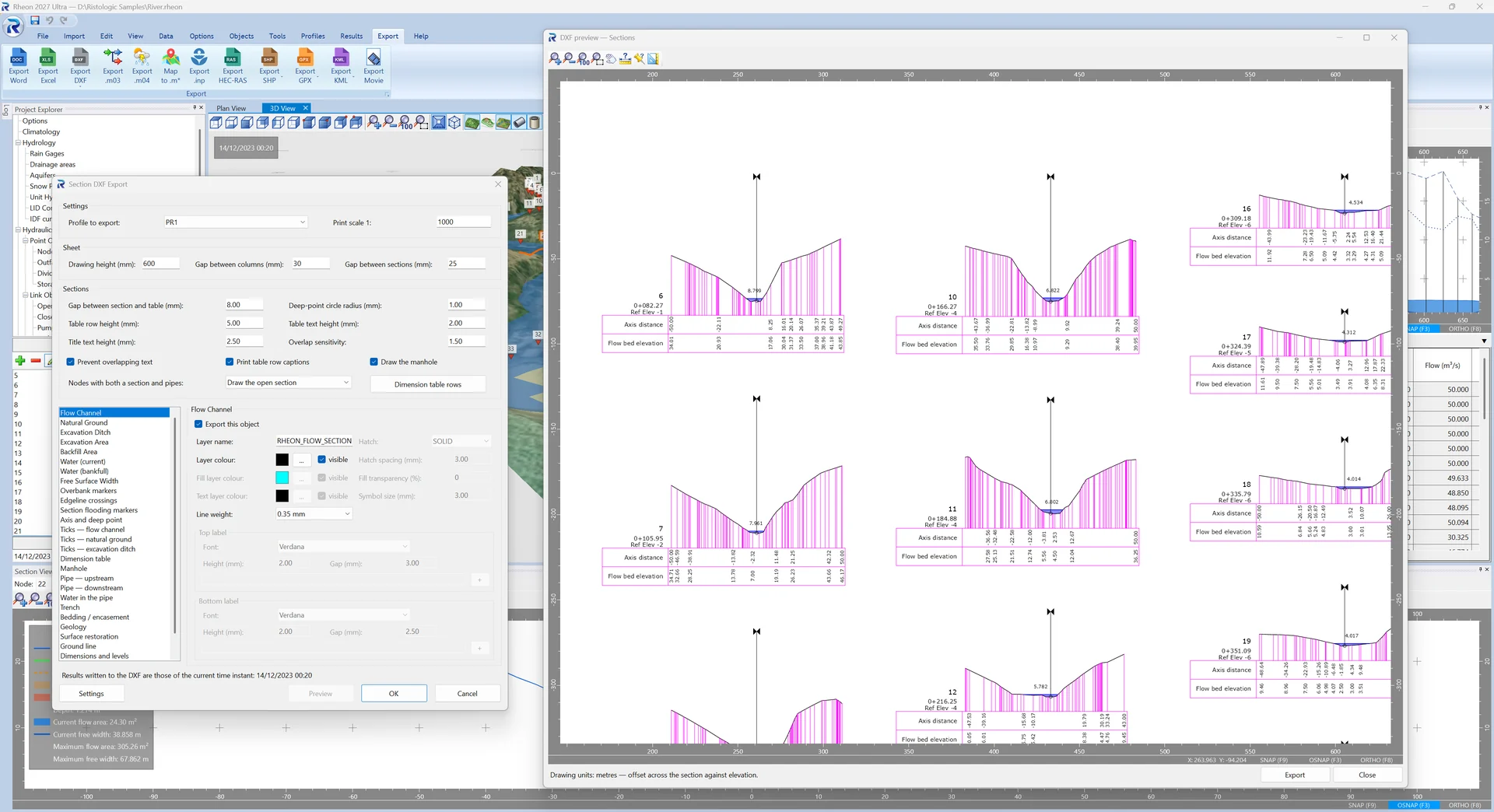
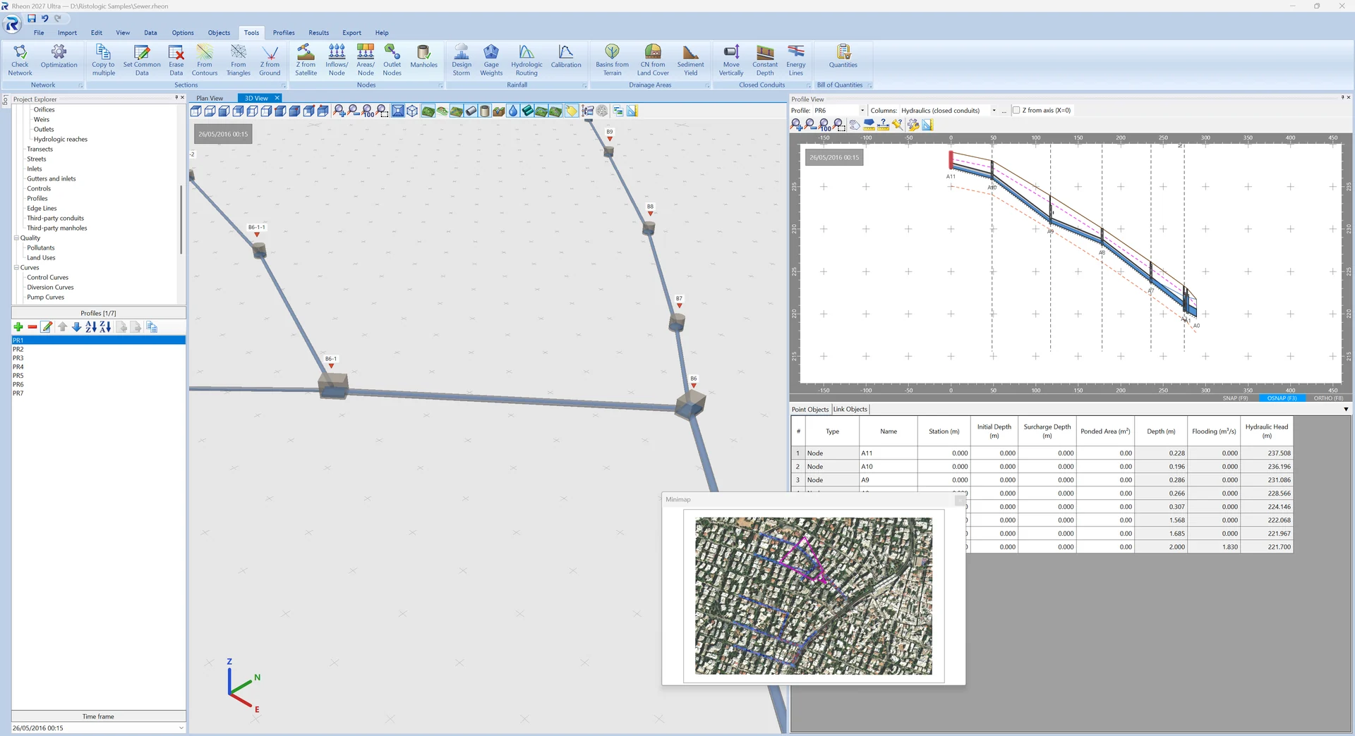
Plan, profiles and sections as DXF, each with its own layers, line types, tables and legend; a multithreaded 3D view of the network on the terrain; movies of a flood on the plan, the profiles, the sections and the 3D view, and flights over the 3D view; satellite imagery and elevations from the web.
Multicore
The 3D view, the terrain processing and SWMM's dynamic-wave solution run in parallel on the processor's cores, as many as you allow in the options.
Quantities and reports
The bill of quantities with excavation, bedding and backfill; the project report printed, previewed or written as a Word document, the results as an Excel workbook — neither needs Microsoft Office on the machine.
Data exchange
SWMM input files both ways; networks, drainage areas and third-party pipes from DXF; river axes from shapefiles, GPX and KML; surfaces from LandXML; HEC-RAS projects in and out (Pro).
An AI assistant beside you Pro
Claude, or any MCP client, can work on the open project with your consent: read and edit objects, run the analysis, report and draw — every change in front of you, and every change undoable.
Rheon editions compared
Every capability, edition by edition — the same table as the manual's. Demo opens and explores projects; Lite is the full program for most offices; Pro adds the advanced tools.
| Capability | Demo | Lite | Pro |
|---|---|---|---|
| Projects and files | |||
| Opening projects (.rheon) and the sample projects | ✓ | ✓ | ✓ |
| Saving projects (.rheon) | ✗ | ✓ | ✓ |
| Inserting another Rheon project's objects into the current one | ✗ | ✓ | ✓ |
| Inserting another Rheon project as a third network, to check for conflicts | ✗ | ✗ | ✓ |
| Undo and redo of every step, the log of actions | ✓ | ✓ | ✓ |
| Printed data report with its print preview | ✓ | ✓ | ✓ |
| Import | |||
| SWMM 5 .inp files | ✗ | ✓ | ✓ |
| HEC-RAS projects: the river's reaches, cross sections, culverts and bridges, with the plan's flows | ✗ | ✗ | ✓ |
| DXF: the background drawing, contours and triangles | ✓ | ✓ | ✓ |
| DXF: the network and the drainage areas | ✓ | ✓ | ✓ |
| LandXML terrain surfaces (TIN) | ✓ | ✓ | ✓ |
| A river axis from SHP, GPX or KML/KMZ | ✓ | ✓ | ✓ |
| Library entries | ✓ | ✓ | ✓ |
| Export | |||
| Word: the whole data-and-results report | ✗ | ✓ | ✓ |
| Excel: the options, and the nodes and conduits at every reporting time, with the sections drawn | ✗ | ✓ | ✓ |
| DXF: the plan view | ✗ | ✓ | ✓ |
| DXF: the profiles | ✗ | ✓ | ✓ |
| DXF: the sections | ✗ | ✓ | ✓ |
| SWMM 5 .inp files | ✗ | ✓ | ✓ |
| SHP, GPX and KML: the river axis and the plan view | ✗ | ✓ | ✓ |
| Movie of the plan, profile, section or 3D view, and of a flight over the 3D view | ✗ | ✓ | ✓ |
| Library entries | ✗ | ✓ | ✓ |
| HEC-RAS: the river's reaches, cross sections and culverts, with their steady and unsteady flows and plans, as a HEC-RAS project and a RAS GIS import file | ✗ | ✗ | ✓ |
| Plan view and objects | |||
| Nodes, outfalls, dividers and storage units | ✓ | ✓ | ✓ |
| Links: open and closed conduits, pumps, orifices, weirs and outlets | ✓ | ✓ | ✓ |
| Hydrologic reaches: Lag, Muskingum and Muskingum–Cunge, routed before each SWMM run | ✓ | ✓ | ✓ |
| Drainage areas, rain gages, edge lines, map labels and profiles | ✓ | ✓ | ✓ |
| Drawing with snaps and exact point input, intermediate vertices of links | ✓ | ✓ | ✓ |
| Layers: satellite images, background drawing, contours and triangulated surface | ✓ | ✓ | ✓ |
| Project explorer, object properties, find and selection sets | ✓ | ✓ | ✓ |
| Libraries: pipes, manholes, trenches, runoff, sewage | ✓ | ✓ | ✓ |
| Renaming of nodes, conduits, drainage areas and edge lines | ✓ | ✓ | ✓ |
| Minimap | ✓ | ✓ | ✓ |
| 3D view: the network on the terrain, the satellite drape, flights along a profile | ✓ | ✓ | ✓ |
| Edge lines from flood lines | ✗ | ✗ | ✓ |
| Third-party networks: drawing and display on the plan, the profiles and the sections, their conflicts with the network | ✗ | ✗ | ✓ |
| Sections and profiles | |||
| Section editor of nodes and section templates | ✓ | ✓ | ✓ |
| Sections of nodes from contours or triangles | ✓ | ✓ | ✓ |
| Sections copied to many nodes, common data, erasing, Z offset from the natural ground | ✓ | ✓ | ✓ |
| Profile view with its grid of nodes and links | ✓ | ✓ | ✓ |
| Section view with the water level of the run | ✓ | ✓ | ✓ |
| Hydrology | |||
| IDF curves: Sherman, Chow, YPEN and tabulated | ✓ | ✓ | ✓ |
| Time of concentration: sixteen formulas, TR-55's sheet flow among them | ✓ | ✓ | ✓ |
| Rational method: each pipe's design flow from everything upstream, with the partial-area check | ✓ | ✓ | ✓ |
| Unit hydrographs, the synthetic unit hydrograph, initial and constant losses | ✓ | ✓ | ✓ |
| Sewage flows and sewage quality | ✓ | ✓ | ✓ |
| Inflows at nodes: direct, dry weather, RDII and pollutant inflows | ✓ | ✓ | ✓ |
| Snow packs, aquifers, LID controls, climatology, pollutants and land uses | ✓ | ✓ | ✓ |
| Dam breach | ✓ | ✓ | ✓ |
| Hydraulics and results | |||
| EPA SWMM 5.2 engine with every option, controls and curves | ✓ | ✓ | ✓ |
| Check Network | ✓ | ✓ | ✓ |
| Hydraulic checks: slopes, velocities, filling (ΟΜΟΕ 12's limit by diameter), section flooding, culvert headwater | ✓ | ✓ | ✓ |
| Culvert crossings: FHWA inlet codes and the roadway weir | ✓ | ✓ | ✓ |
| Open channels: filling to the lower bank, flooding of the section, flood lines | ✓ | ✓ | ✓ |
| Results: status report, summary tables, time series, profiles and sections at every step, statistics | ✓ | ✓ | ✓ |
| Animation of the results on the plan, the profile and the section | ✓ | ✓ | ✓ |
| Result curves and object colours by result | ✗ | ✗ | ✓ |
| Tools ▸ Nodes | |||
| Ground elevations from a web service, the TIN, contours, a terrain file or the Copernicus DEM | ✗ | ✗ | ✓ |
| A total inflow split over conduits by their length | ✗ | ✗ | ✓ |
| A total sewage area split over conduits by their length | ✗ | ✗ | ✓ |
| Outlet nodes of drainage areas, the nearest to their centroid | ✗ | ✗ | ✓ |
| Manhole types by rules | ✗ | ✗ | ✓ |
| Tools ▸ Rainfall | |||
| Design storm from an IDF curve: alternating block, Chicago, uniform, SCS 24-hour, Huff or a pattern of your own, with the areal correction and the depth-area analysis per point | ✗ | ✗ | ✓ |
| Gage weights: Thiessen polygons, inverse distance or typed | ✗ | ✗ | ✓ |
| Hydrologic routing: each reach's inflow and outflow, attenuation and lag | ✗ | ✗ | ✓ |
| Calibration of the parameters to a measured flood | ✗ | ✗ | ✓ |
| Tools ▸ Drainage Areas | |||
| Basins from terrain: the TIN, a LandXML or DXF surface, or an ASCII grid | ✗ | ✗ | ✓ |
| Curve numbers, runoff coefficients and impervious shares from land-cover and soil maps | ✗ | ✗ | ✓ |
| Sediment yield by MUSLE | ✗ | ✗ | ✓ |
| Tools ▸ Closed Conduits | |||
| Move vertically | ✗ | ✗ | ✓ |
| Constant depth below the ground | ✗ | ✗ | ✓ |
| Energy grade lines of HEC-22 with FHWA's access-hole losses, drawn on the profiles | ✗ | ✗ | ✓ |
| Quantities and optimisation | |||
| Bill of quantities: excavation, bedding, backfill | ✗ | ✗ | ✓ |
| Optimisation of pipe sections: the cheapest library sections that carry the design flows | ✗ | ✗ | ✓ |
| Gutters and inlets | |||
| Gutters drawn on the plan or taken from the drawing, their levels from the TIN or typed | ✗ | ✗ | ✓ |
| Design to HEC-22 (2024), ΟΜΟΕ 12 or CD 526 with CG 501, or to criteria of your own | ✗ | ✗ | ✓ |
| Gutter sections: curb, V without a curb, V-shaped median, circular, curb with a parabolic crown | ✗ | ✗ | ✓ |
| Inlets on grade and in sags: grates, curb openings, combinations, slotted drains, drop grates and drop curbs, circular scuppers, with clogging | ✗ | ✗ | ✓ |
| Spread and depth limits, the sag's zone and its flanking inlets | ✗ | ✗ | ✓ |
| Proposal of the inlets' places | ✗ | ✗ | ✓ |
| Hydroplaning check and the driver's visibility | ✗ | ✗ | ✓ |
| CG 501's climate allowance, sensitivity test and flooding check within the highway boundary | ✗ | ✗ | ✓ |
| Gully pot capacity (CD 526, HR Wallingford SR 508) | ✗ | ✗ | ✓ |
| Bridge decks to HEC-21: kinematic-wave inlet time, flat decks, scuppers | ✗ | ✗ | ✓ |
| The spread band on the plan and in the 3D view, the gutters' sheet, the printed report, Check Network | ✗ | ✗ | ✓ |
| Inlets written into the SWMM model | ✗ | ✗ | ✓ |
| AI connection | |||
| An AI assistant (Claude or any MCP client) working on the open project beside you, with your consent, through the window's own commands, with pictures of the plan and the panels | ✗ | ✗ | ✓ |
| Interface and support | |||
| Interface in English, Greek, German, French and Spanish | ✓ | ✓ | ✓ |
| The manual in English, Greek, German, French and Spanish, F1 help in every window, EPA's SWMM help | ✓ | ✓ | ✓ |
| Number display: decimals, decimal symbol, digit grouping | ✓ | ✓ | ✓ |
| Report a problem, check for updates | ✓ | ✓ | ✓ |
System requirements
- Operating system
- Windows 10 or 11, 64-bit
- Engine
- EPA SWMM 5.2
- Languages of the program
- Ελληνικά · English · Deutsch · Français · Español
- Manual
- Greek, English, German, French and Spanish (PDF and HTML help)
- Microsoft Office
- Not needed for the Word and Excel output
- Support
- support (at) ristologic.com
See it on your own projects
Ask for a quote or for the demo edition.